
Tasman Glacier facts in the landscape
Tasman Glacier facts are easiest to understand by separating the glacier, the lake and the old ice margins. DOC describes Haupapa/Tasman Glacier as New Zealand’s longest glacier. The public viewpoint looks across a landscape in which the glacier’s changing position has left visible traces. The lake and moraines put those changes into a wider landscape setting.
The public walking routes provide a way to observe that setting without entering the glacier. A guided ice walk, a lake visit and a flight offer different perspectives, but they remain separate activities. Start with the View Track guide to understand the land-based visit, and use the lake guide for the water and shoreline context.
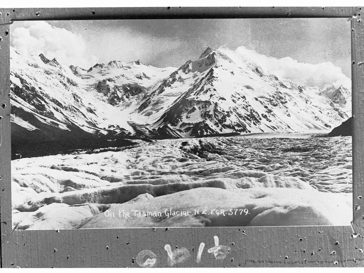
Lake formation from 1974
DOC dates the beginning of Tasman Lake’s formation to 1974 and describes the lake growing as the glacier retreats. The lake is therefore part of the changing glacier landscape, rather than a fixed foreground to an unchanging body of ice. Old terminal moraines record former ice-edge positions. On the lake and river walk, plant recolonisation adds another visible element to that story.
The distinction matters when comparing a historic photograph with today’s visit. A photograph records one view at one moment. It does not by itself provide a new survey of length, depth or the rate of retreat. Look for the relationship between debris, water, vegetation and the remaining ice rather than trying to turn the picture into a measurement. Icebergs can be present, but their appearance is not assured for an individual visit.
See the glaciers from the air
A flight from Franz Josef offers a view of both glaciers as a visit alongside their landscape history.
Hand-picked tours, booked through GetYourGuide. Prices are indicative starting prices in US dollars (as of October 2026). Tap a tour for live availability and the current price in your currency.
A flight over both glaciers from Franz Josef
Depart from Franz Josef for a thirty-minute scenic flight over Franz Josef and Tasman glaciers, with an alpine glacier landing and safety briefing.
Blue Lakes and a different source of water
The Blue Lakes illustrate another part of the valley’s change. DOC describes them as green and rain-fed today, rather than their former glacial blue. Their name therefore carries a historical reference which does not promise the colour a visitor will see. Treat the lakes as a landscape feature with a changing water source, not as a colour test for whether the visit has reached the right place.
The Blue Lakes branch belongs within the walking area, while the moraine viewpoint and lake-and-river path offer other perspectives. Keep to the described public routes and follow DOC’s local access advice. These are ways to read the valley from land. Enter the glacier or go onto the glacier lake only with a guide; stay out of the water and off frozen lake surfaces and icebergs.
Long-term ice loss and the March 2026 observations
NIWA’s statement of 31 March 2026 described more remaining snow on some glaciers during that March survey than in previous years. It also made clear that this did not reverse the long-term loss of glacier ice. A snowier appearance in an individual observation should therefore be understood within a longer record, rather than used as a claim that the glacier has recovered.
For a visitor, dates attached to figures matter. DOC’s web description is undated, while its walking brochure was printed in October 2022. Read that brochure as older context rather than a present-day measurement. The landscape history can be explained through DOC’s lake formation account and NIWA’s long-term assessment without attaching a current Tasman retreat rate to the view. Older numbers should not be projected forward to the travel date.
Aoraki, Ngāi Tahu and park history
DOC describes Aoraki as a particularly sacred ancestor of Ngāi Tahu and explains the mountain’s Tōpuni status. This relationship belongs to the community and deserves respectful treatment. It provides context for visiting the wider mountain landscape, rather than a promise of a cultural performance or guided cultural tour at Tasman Lake.
The wider mountaineering and national park story belongs with Aoraki / Mount Cook. For a visit in the protected landscape, DOC prohibits recreational drones, dogs and other pets, and maintains a permanent fire ban. Carry rubbish out and follow the relevant site rules. Care for the place is part of understanding its history, rather than something separate from the viewpoint visit.
West Coast comparison and the flight from Franz Josef
For a separate glacier destination, see Franz Josef Glacier. Keep the departure location clear when comparing experiences: the thirty-minute flight featured on this page starts at 69 Cron Street in Franz Josef, on the West Coast. Its route flies over Franz Josef and Tasman glaciers and includes an alpine glacier landing and safety briefing. Food and beverages are extra.
This is a scenic flight rather than a history tour, and its landing is not promised on Tasman Glacier specifically. Weather influences flying and landing arrangements. Compare the flight guide for the other departure options and the weather planning guide for a flexible itinerary. A view from the air complements the landscape story without replacing the distinction between flight, landing and guided ice walking.
Questions before your visit
When did Tasman Lake begin to form?
DOC dates the beginning of lake formation to 1974 and describes its growth alongside glacier retreat.
Are the Blue Lakes still blue?
DOC describes them as green and rain-fed today. Their name reflects an earlier glacial-water setting.
Does the featured flight start at Mount Cook?
It starts at 69 Cron Street in Franz Josef. It is a scenic flight over both glaciers, with no specific Tasman landing promised.